Showing posts with label Transportation. Show all posts

Sunday, February 17, 2013

Innovations at Traffic Signals for Cycling: Would a Thermal Imaging Camera Improve Detection

The first person detected by the thermal imaging camera in Portland. 
I presented on the topic "Innovations at Traffic Signals for Cycling" at the most recent meeting of the Oregon Section of the Institute of Transportation Engineers. There were a few new things we had done in the past year that I felt compelled to share information about. The most recent was a Thermal Imaging Sensor. Before I go into detail on that, let's review some of the recent innovations we have implemented in the past year.
In June, we repurposed our school zone enforcement light as a bike detected confirmation light. We have installed these at two locations and the response from their use has been very positive from the user community.  One of the reminders from the meeting was something that Rick Nys, the Clackamas County Traffic Engineer mentioned. He highlighted that the County used feedback from BikePortland.org to guide their improvements of the first bicycle signal in their system. He also mentioned that the response from the bicycling community was so positive that "it makes them want to do more of these types of projects".

The other innovations that I described included the Dutch Bicycle Countdown to Green signal I have described before, but haven't found a way to bring to the U.S.


The newest innovation that we're studying is the use of a thermal imaging camera made by Flir/Traficon. Traficon was recently purchased by Flir and it is interesting to consider a company like this getting into the traffic business.
Flir cameras come from military applications
 That hasn't always worked so well for other companies, but I am hopeful that they will be in it for the long haul. The good news with this situation is that there is an existing expertise with Traficon which is a Belgian company. The company representatives that we met with during the install of this unit suggests that we should be able to do what we want to detect bikes and distinguish their heat signature from that of a car. We'll study the equipment similar to what we did with the microwave and video detection at the Broadway Bridge NW Lovejoy intersection.

Here's a summary of the presentation in pictures.
The location of the test is SE Cesar E Chavez and Lincoln, a popular
bike route that is busy during the commute periods. 
I mentioned it was busy, this was after the morning peak and
people on bikes outnumbered vehicles even on a rainy day.
The push button here is mounted so the person on a bike
can reach it, but it isn't easy. The other direction is impossible to
activate from the street.

A peek in the cabinet of the equipment, the display was temporary,
but we do have access to the images back in the Traffic Operations Center.
I am looking forward to having this studied and learning a bit more about future applications.

Friday, January 4, 2013

TRB Traffic Signal Systems Committee Meeting Agenda


Traffic Signal Systems Committee Meeting

Marriott Wardman Park – Wilson B&C

Monday, January 14th, 2013

Peter Koonce, Chair              Susan Langdon, Secretary            Larry Head, Past Chair

1:30 PM   Welcome, Introductions, Approval of Minutes 

1:45 PM   TRB Report, Rich Cunard

1:55 PM FHWA Reports, Eddie Curtis, Paul Olson, Rick Denney

2:15 PM  Task Force/Subcommittee Reports

            *NEW Subcommittees are underlined *
TRB Paper Review – Larry Head/Peter Koonce
Best Paper – Paul Olson
Infrastructure Performance Measurement/Asset Management – Paul Olson
Multimodal- Kevin Lee
Simulation – Brian Park
Signal Timing – Jim Powell *NEW Chair*
Technology & Standards -  Doug Gettman
Research – Alex Stevanovic *NEW Chair*

3:00 PM  NCHRP Update – Ray Derr

            Research Problem Statement feedback (tie to Alex Stevanovic Subcommittee)
Short presentation by contractor of NCHRP 3-103 - Tom Urbanik

3:30 PM Break

3:50 PM  Multimodal Signal Research – Larry Head

Short presentation on recent research and deployment of Connected Vehicle

4:10 PM  Highway Capacity Quality of Service – Janice Daniel

            New features in the Urban Streets Chapter, future research

4:25 PM  2013 Summer Meeting Workshop – Peter Koonce

            Refinement of topics to be discussed, solicitation of field trip ideas

4:40 PM  Triennial Strategic Plan – Peter Koonce

5:00 PM  Other Business – Peter Koonce

E-mail peter.koonce@portlandoregon.gov in advance if you have an item to share

5:30 PM  Adjourn

Tuesday, July 10, 2012

Visiting Houten - Bicycle Heaven, "Fietsstad 2008" - presentation by Andre Botermans

Andre Botermans from Houten
Andre is a planner with the city and had a tough act to follow from last year when Herbert Tiemens, an Engineer gave us the presentation in 2011. He started with a history of the town and nearby Utrecht. In 1867, it was 1600 people. It had a rail station that was central that ultimately became central to its development. Nearly 100 years later, in 1950, it was the same size.

In 1966, the regional government decided to build houses in cities and it was declared that  the rural areas would stay free from urbanization. Houten was tabbed in the second round of growth to 100,000. Citizens fought back and the number was reduced to 30,000. Paper on Spatial Planning - Structuurschets 1e groeitaak

Example of a park along the Houten Bicycle Highway. 
The Dutch used "Rational" Urban Planning based on the small scale, conscious of nature and the environment. Andre indicated that it was developed in a time before sustainable development was a fully formed concept. The idea started with the idea of a Bicycle City, leading bicycle routes to the train station. Car infrastructure was set up as a ring road without connections internally between sections of the neighborhood were going to emphasize bike safety by reducing interactions with cars. Also, cars are asked to give way to bikes in all cases and separated at the ring road.


The primary schools are located near the Central Greenway so access for children is guaranteed.  Parks are located throughout the city and many are connected to the Greenway.

Bottle return by bicycle (he biked with two on
the rear rack and had two more 12 packs in his
panniers).
In Houten, "most of the things we do by bike". Everything is at such a short distance: shopping, school, parks, etc.
On the ring road, there are higher buildings to design as a gate to frame the entrances where you can go into the living area. The intent was to base the design like an old Roman town. These larger buildings on the Ring Road are often offices or else often used by elderly as they get a nice view of the countryside as apart of their location.

There are very few long roads, in fact the maximum tangent section used in planning is 250 feet. All of the bike routes are in red asphalt to communicate the intent of each facility.

They are planning a new roadway connection to A12 that will relieve some of the congestion to the main link to the freeway system.

Houten's bike safety record and crash rate is 31% of Dutch cities of comparable size because of the limited interactions necessary. When thinking about this, I think this is a result of a high percentage of families (it is a suburb) and the higher income and education level than comparable cities. Nationally, 49% of the houses are owner occupied. Houten is 70% owner occupied and the second phase will be 80%. There is a lot of discussion about this that could be called go question. Houten is a more expensive suburb than many surrounding communities. So to say that Houten's unique design makes a community 70% safer would be an overstatement, but Andre didn't make the case for that, he just stated what the results are.

Bicycle parking in the Houten train station. 3,000 spaces!
Bike parking is fantastic at the Central station, with over 3,000 spaces. It is massive and free. No subscription or annual cost for parking bikes. They have 200 bikes often left over night, but they don't worry too much about that as they can sign them as needed and pull them away.

There is security cameras for the facility and a bike shop so that you can get help if you need it. The OV Fiets rental is also there if you don't have a bike and need one for the day. A little more on the facility here.


Andre indicated that there are a lot of cars in Houten. A lot of the families have dual income with kids so they have the means to buy cars. Many of the jobs in the community are white collar. The city estimates that 1/3 of employment is in Houten, 1/3 is in Utrecht, 1/3 is elsewhere. Future growth will seek to have equal jobs and the number of people. Utrecht is a 12 minute train ride to downtown Utrecht. Jobs outside if the Utrecht Central are accessible by bike or by transit transfer.

A few other interesting facts worth sharing about the community:

Housing in Houten has some unique
features, including these that are right
on the water.

  • The City wants to be careful to implement jobs with their expansions with the intent to use this to reduce GHG. 
  • 23 houses per hectare us the approximate density of housing. New area is 24 per. About 10 per acre. Pijnacker (near Delft) is 34 or 15 per acre.
  • The City officials are going about retrofitting the old village circa 1950 to make it consistent with the current standards, but it is occurring slowly due to financial constraints.

The "second growing task from the National Government is issued in 1991 and again Houten was not willing to grow, but the compromise was to end up at 60,000. Andre described several concepts that were laid out. Ultimately, the planners focused a new town along the railway south of the existing part. The urban planner was Rob Derks, who is retired now, but still lives in Houten. The new area has no central greenway, but a five sided greenway that has a smaller center and the existing center is strengthened.

The new town center of Castellum included medium density
around the city's second train station.
The south section was chosen by the municipality, but the land was owned by speculators. Thus, the municipality had to partner with the developer and it took a long time to get to a solution that wasn't too dense for Houten's vision. The new site is called Castellum and that has also been planned around a new station. Houten's existing center is intended to grow and the new south center will be a minor station.

It seems like a pretty fantastic minor station that if we completed community planning as they do would be a vast improvement in the Portland metropolitan area, but of course the existing communities are not nearly as farm focused and the development of streets and all of the other infrastructure is much different than the U.S. experience.

UPDATE: Here's a Youtube video summarizing Houten.


Wednesday, July 4, 2012

Haaglanden Regional Planning - Day 3

The speaker on Day 3 was Jan Termorshuizen from the Haaglanden who was has lectured to the class each year.
He described the overview of the region and what he's involved with. He highlighted the region's  Randstad Rail, cycling policy, physical planning and public transport, and Integral Planning.


An example of Integral Planning is the consideration that the Dutch must have for where water goes. Considering that much of the country is below sea level this is critical.

Population and Land Area - Details of the Hague

He described the Netherlands and compared it to the population and land area of Massachusettes, Conneticuit, & Rhode Island. From Wikipedia.

Area(2006)
 • City andmunicipality98.20 km2(37.92 sq mi)
 • Land82.66 km2(31.92 sq mi)
 • Water15.54 km2 (6.00 sq mi)
Population (1 February 2012)
 • City andmunicipality501,725
 • Density5,894/km2(15,270/sq mi)
 • Urban1,022,256
 • Metro1,406,000


He also indicated that there are 15.3 sq. km of Industrial estates and 35 sq km of greenhouses.

Regional Planning Over Time


The regional government is guided by the intent to "Do local what can be done local, Do regional what must be done regional", suggesting that there are some communities that aren't large enough to have the expertise to serve a community effectively. [My experience in private practice indicated that there was wide variety of expertise in government agencies of all sizes].

Jan described the history of planning based on his 30 years experience. In the 1970s and 1980s he indicated that the Dutch had a policy of "Bundled Deconcentration" with new light rail lines in Rotterdam, Den Haag, and Utrecht. There were more cars during this period and larger houses. They used selective urban renewal which included displacing people.

In the 1990s there was a shift to build at the edge of the cities and extend urban railways systems. There was quite a bit of effort to complete traffic demand management measures. People didn't like the demand management portion, so when there was success there was a change in how the policy was communicated.  Jan introduced the ABC land use zoning with A being the type of office that you can easily serve with transit and C being auto focused development. They began using their ABC location policy of offices being very important to be near rail stations and recognizing that not all development needs to be well served by rail or public transport and finding success. They have been very good in recognizing the importance of this and integrating bicycle use throughout all different types.

In the 3rd Millenium, he characterized the lack of money for investment and public transport operations. There is a more business like approach of public transport and reuse of existing

Their goals is to include 60-80% of new housing within close proximity of high quality transit lines. An example of this is that the new Delft rail station will be 1,500 housing units and a City building integrated there as well.

History of Community Planning in the Haaglanden

Pijnacker in 1950 was a small community, "village" on the rail line between Den Haag and Rotterdam. Nootdorp was off the rail line but in between Den Haag and Pijnacker.

Zoetermeer was a new town in 1965 when there was recognition of the need for more housing and became a much larger urban area. The planners focused a significant energy around that area and there were several areas to the southwest of Den Haag and Tanthof.

He indicated that it was not a good development because there were limited jobs in Zoetermeer, so people had to travel. It was also too far away to make cycling a reality (Dutch range of cyclists is 12 km away), and few people are biking to their jobs. Zoetemeer is off the major rail line between Den Haag and Rotterdam, so it only has a rail connection (spur line) to the central city and the frequency was not high enough because there were not enough people at the Den Haag Central Station to make it attractive.

The central city of Zoetemeer also suffered from lower densities than most of the communities. Most of the development were 2 stories. There were a few 20-story buildings, but they weren't very popular.

Ypenburg was built in 1995 and was a former Air Force Base. The community included an expansion of the existing tram system into the system and there was also a new railway station on line between Utrecht and Den Haag. Being on the major rail station gives Ypenburg a distinct transportation advantage (for serving non-auto trips). It is also only 5km from The Hague, so cycling is an option for more of its residents in getting to work.

Future plans from Zoetermeer is to reconstruct the heavy rail line to be part of Ranstad Rail so that there is more local service and it is a more comprehensive system. The smaller vehicles offer cheaper service and there can be higher frequencies. The light rail trains have better accel and decel properties, so overall Jan felt it was a higher quality of service for accessibility.

Future of Planning and Public Transport

There's a recognition of some of the missteps from the past and energy is being focused on using operations at stations along public transport lines. There interest currently in developing along exsting railways and trying to avoid office developments in decentralized locations.

Peter Furth indicated that in Boston, the suburban communities are fighting for office space because they pay additional taxes than residential property and they don't send children to schools (which the locals have to pay for as well). The Hague doesn't seem to have any issues that are similar to this.

Jan described the current focus on Integrating Public Transport into community. There are 8 principles:


All areas have a direct PT link with city center and one of two main railway stations
All stations have one or more light rail with stops near the main entrance.
All homes have a PT stop at a maximum distance of 500m
Trams have high frequencies, so transfer is no problem
All railway stations and many tram stops have bicycle parking facilities.
Many railway stations have park and ride facilties
Bicycles in trams are not permitted, in light rail only after 7:00 PM and in weekends
Popular OVfiets (PT bike) system: www.ov-fiets.nl will be integrated at each station.


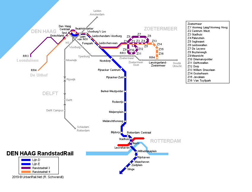
Jan summarized the Randstad Rail system map and how it influenced the planning.  I haven't actually used the tram during my time in Delft. I have used the bus, but not the tram. The map of the Delft Line 19 that is being expanded to the TU Delft campus.

Enough summarizing the presentation. It's now time for the tour of the community!


Monday, July 2, 2012

Dutch Bicycle Signal with Through Arrow - Clarifying Intent of Traffic Control - Den Haag, Netherlands

 In discussing bicycle signals with fellow transportation engineers, I am consistently asked what the green indication is intended to mean to a person on a bicycle. I am perplexed at this question because I believe that one could ask the same question for a circular green indication that is used for all traffic. With a circular green, it does not mean you should turn left (in your motor vehicle) from the right most lane of traffic.

That was exactly what a recent discussion inquired about. I hadn't ever considered whether a bicycle signal indication would given a person on a bicycle the clue that they could turn left from the bicycle lane across vehicular through lanes, essentially stopping all traffic in favor of the traffic in the bicycle lane. In our nine bicycle traffic signals in Portland, only a few of them are for the bicycle lane where there would be an opportunity to make a left turn across several lanes of through traffic, but I don't think that's a logical conclusion for a cyclist to make when there are other adjacent traffic signal displays or through arrows in adjacent lanes.

The pictures in this post show an example in Den Haag where some clarification was deemed necessary of the intent of the traffic signal and there was a need to provide clarity related to the bicycle signal was intended to control through traffic (note the small through arrow in the larger signal head at left. As you can see in the photo, the red pavement curves to the right, but this traffic signal is intended to control the through movement.  
Posted by Picasa

Sunday, July 1, 2012

Bike Overcrossings in Rotterdam - Complete with Supersized Escalators


Our leisurely Sunday bike ride provided us some further insights on the lengths the Dutch will go to provide an efficient and effective connection for people on bicycles. We decided to travel south through Rotterdam to evaluate some of the treatments in and around the third largest freight port in the world.  We turned up some very nice infrastructure without really looking for it. This and the Benelux tunnel post shows what sorts of accommodation is built alongside major highway upgrades.

This portion of the ride was the south most part of our effort.

This particular facility (shown in the pictures) was built alongside the A4 & A15 freeway to freeway interchange at the intersection of Vondelingenweg and Oud Pernisseweg. The facility provides access to Pernisserpark which is a nice outdoor space next to two very busy freeway facilities in a heavy industrialized area. We were there Sunday and the traffic was constantly buzzing on the freeways with a good amount of noise, so I can imagine it is louder during the week.


The screen capture shows the GPS track that was part
of the overcrossing of the rail tracks.
The overcrossing is in the southern portion of Rotterdam in the area called Hoogvliet and continues into Schiedam to the north. The short back tracking from the north to the south resulted in backtracking to take pictures of the highway A 15 below. The tracks match closely to our use of the ramp down in the northbound direction. 


A view from the top of the structure looking back at the separation.
Rail on the left and the "elevated right turn" we just made.
The cover for the escalator reminded me of the
sand crawler vehicle the Jawas used in Star Wars. 


This is the entrance to an escalator that allows people on bicycles to make a right turn over several freight railroad tracks. Obviously, it wouldn't be desirable for a cyclist to cross the heavy rail at grade, so this escalator is a facility that gets people up to the grade where they can crossover without any conflict. It uses the old road right of way ( I am assuming) that was vacated after the A4 highway was built.  Similar to the Benelux tunnel, one could argue whether this sort of facility (I almost called it an amenity) is necessary. There are many examples of interchange ramps where there isn't special provision for cyclists of this magnitude that work just fine. I will be interested in exploring this with the guest speakers we have and I am hoping there is someone that might discuss the specifics of this type of investment.   
Posted by Picasa

Tuesday, March 27, 2012

NACTO Bike Guide Training at the Oregon Active Transportation Summit

The Oregon Active Transportation Summit (OATS) annually offers education on a broad array of active transportation topics. This year’s Summit will be April 16-17 in Salem.

Offered on Monday, April 16th of the summit will be an intensive day-long training on the National Association of City Transportation Officials (NACTO) Bikeway Design Guide. Completing the training offers 6 professional development hours.

The NACTO Guide presents both detailed designs and examples of how best practice bikeways are being implemented throughout North America. The training—taught by Roger Geller, Rob Burchfield and Peter Koonce—will cover the 21 designs found in the guide as well as other treatments in use, but not yet covered there. The course is intended for traffic engineers, project managers, planners and anyone interested in the nuts and bolts and discussion of more recent bikeway designs.

To take the course, register here for the summit!
Registration is $50, which includes conference sessions, lunch and the evening reception. In addition to the bikeway design training is a full two-day agenda that promises a stimulating summit. If you cannot attend both days at the least please plan to stay for the evening talk and reception that follows.

A hard-copy of the NACTO Guide is available for an additional $40 when you register.

Monday, February 27, 2012

Documenting Efforts on NE 12th Avenue: 4 to 3-lane Conversion

I got an email from another colleague regarding the experience converting a 4-lane to 3-lane conversion on NE 12th Avenue. I could spend a lot of time to describe it or I could summarize blog posts that BikePortland.org had on the subject in chronological order with better reporting than I could accomplish at home in the evenings after work.

Pushback on the Plans - are signals enough? - April 28th: This was the time I got involved. There was some earlier work on the concepts, but I hadn't done a whole lot of new information.

Implementation Notice - June 2nd: PBOT implemented the signal changes with some striping modifications before the school year ended.

Moving Forward with Concerns - June 16th: A second meeting was held to discuss initial results.

Consensus with the Stakeholders! - September 29 : We studied the after when school was back in session to do a reasonable comparison.

Implementation pictorial: The completed project, we still have a few things to modify and we committed to evaluate the after before the end of the year. We haven't had any complaints that we were not able to address.

Wednesday, February 15, 2012

The Misuse of Traffic Engineering for Active Transportation

I just submitted the following Conference Session for the Oregon Active Transportation Summit.

The traffic engineering community is advancing methodologies to accommodate active transportation. Adoption of new methodologies and standards has not been widely accepted because there remain gaps in the standards by which we determine facilities are adequate, particularly in the development review process. This is highlighted in the vocabulary we use on a daily basis, we continue to consider auto traffic congestion as something that should be reduced, when in reality it can support the encouragement of active transportation. This session will describe these challenges and provide attendees technical policy suggestions that would make active transportation more competitive in their community.

Here's the rundown of Speakers

Todd Mobley of Lancaster Engineering has over 15 years of experience in transportation engineering. His firm serves private sector clients throughout the Portland metropolitan area, guiding them through the complicated land use transportation requirements public agencies use to determine whether a development application fits the community. Todd is a weekend warrior during the cyclocross season and a wicked one at that.

Jessica Horning is a Transportation Analyst with experience in the areas of bicycle/pedestrian planning, transit systems planning and analysis, and geographic information systems (GIS). Ms. Horning has served as Deputy Project Manager for multiple long-range Transportation Demand Management (TDM) planning efforts, which have aided jurisdictions/agencies in developing and promoting alternatives to driving alone (e.g., biking, transit, telework) and also serve as policy and management documents for local TDM programs. She’s an avid bike polo player and you’ll find her most Sundays on Alberta Park’s tennis courts.

Monday, February 6, 2012

Misuse of Level of Service and Travel Projections

This is the post that I wanted to write if I had only made the time. Nice debate on the use (or misuse) of Level of Service.


Levels of Service and Travel Projections: The Wrong Tools for Planning Our Streets? by Project for Public Spaces

This makes me think of Jane Jacobs and the Death and Life of Great American Cities. There were so many notable quotes from that book that bear repeating in our engineering curriculum that it's one of of the primary motivations for my being involved in training. A great insight into that book was offered by Kirk Paulsen who attended the PSU trip to the Netherlands this past summer. His post is here

Wednesday, January 25, 2012

Institute of Transportation Engineers - Oregon Section - Technical Workshop


Registration Online at www.oregonite.org
Leadership in the Profession
Oregon ITE Winter Workshop - Feb 1
Location: ODOT Region 1 – 123 NW Flanders, Portland, OR


8:00 - 8:30       Registration & Networking                                      (Refreshments)
8:30 - 8:45       Introduction
Bob Pappe, Oregon Department of Transportation State Traffic Engineer

8:45 - 9:00       Overview of the Day
Peter Koonce, Portland Bureau of Transportation & Oregon ITE President

9:00 - 10:00     Perspectives on Leadership from the Director or Transportation Level
                        Tom Miller, Portland Bureau of Transportation Director
                        Cam Gilmour, Clackamas County
                        Martha Bennett, Metro Chief Operating Officer

10:15 - 12:00   Highway Capacity Manual 2010 – An Introduction and its Application
Mark Vandehey, Kittelson & Associates, Inc. – Lead on HCM 2010
                        Luigi Casinelli, HDR – NYCDOT Case Study on HCM 2010 Application

12:15 - 1:30     The CEOs Perspective on Leadership                       (Lunch provided)

We are in a time of unprecedented economic challenge. What qualities are CEOs looking for in employees and how does that relate to ITE members and advancement of the profession?

Mark Vandehey, Kittelson & Associates, Inc.
                        Mia Birk, Alta Planning & Design
                        Randy McCourt, DKS Associates
                        Ralph Batenhorst, HDR

1:30 - 2:30       Applying Performance Measures – What’s the Future Hold?
            Moderator: Tom Armstrong – City of Portland Bureau of Planning
Lidwien Rahman, ODOT Region 1 – Alternative Performance Measures Study
                        Peter Koonce, PBOT – Measures that Move us Toward our Multimodal Future
Joe Marek - Clackamas County – Incorporating Safety into MOEs

3:00 - 4:00       Advances in Data Collection & Performance Measures of Tomorrow
                       Kelly Clifton, Portland State - New Techniques in Data Collection
                        Ted Trepanier, INRIX – New Sources of Data from the Private Sector
                        Steve Perone, PTV America  - Modeling and its Role on Performance

Monday, January 23, 2012

TRB Day 2 : Traffic Signal Systems Committee Meetings

It was a TRB that I will never forget. It was on this day that I was named the TRB TSSC Chair. Reading that, it is a corny statement, but it is a nice achievement and I look forward to making a few changes here and there as I can. My play by play twitathon of the action is copied below.

Prior to that tweet, I had reported on the Signal Timing Subcommittee which is also provided below. I am not sure whether this is worthwhile or of interest to folks, but it does perhaps provide a little more exposure to signal timing efforts within TRB as a whole by using the hashtag "#" and the TRBAM which of course stands for TRB Annual Meeting. Referencing various folks doing the work ends up getting broader exposure and sharing the good news. It seemed to be a nice way to share and the younger folks seemed a bit more interested in the social media than the older professionals.

This whole use of Twitter is very much inspired by Mayor Sam Adams' dedication to the site, so if anything I should blame him for this. In all seriousness, it is helpful in remembering ideas and people, so I think long-term it is a good way to recall ideas (similar to blogging or journaling).

There was definintely a lot of interest in signal timing as exhibited by the last post of this binge tweeting session.